Linear corridor intelligence
Pipeline ROW Intelligence
Actionable corridor data for access, encroachment, erosion, and ROW condition.
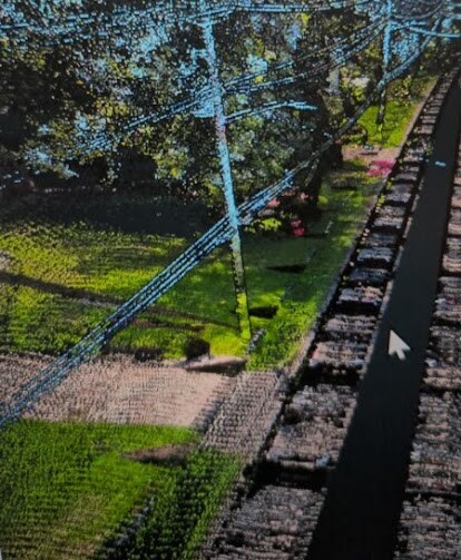
LineScan combines high-resolution imagery and LiDAR where measurable terrain, vegetation, clearance, slope, drainage, or change information is needed. The result is a practical, repeatable record of pipeline ROW conditions.
Practical uses
- •ROW baseline capture
- •Encroachment and unauthorized-construction observations
- •Vegetation and access-obstruction mapping
- •Terrain, slope, drainage, erosion, and washout concern points
- •Access-road condition documentation
- •Construction and restoration verification
- •Repeat patrol comparison and change detection
Potential deliverables
- ✓High-resolution ROW imagery
- ✓Vegetation and access-obstruction maps
- ✓Encroachment observation layers
- ✓Erosion and drainage concern points
- ✓Access-road condition notes
- ✓GIS layer package
- ✓Executive condition or risk summary
Important use note
LineScan provides observational, planning, and documentation support. Deliverables are not pipeline integrity assessments, engineering certifications, regulatory compliance determinations, or substitutes for operator inspection and licensed professional review.