Utility corridor intelligence
Utility & Co-op ROW Intelligence
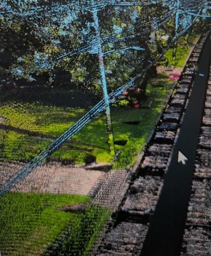
LineScan helps electric utilities, co-ops, and vegetation-management contractors understand and document conditions across rights-of-way using LiDAR and high-resolution imagery.
Discuss a ROW assessment
Practical uses
- • Vegetation encroachment and hazard-tree prioritization
- • Tree canopy, clearance, height, and density review
- • Pole and span corridor documentation
- • Access-road condition and obstruction mapping
- • Drainage, erosion, and storm concern points
- • Pre-work planning and contractor work packages
- • Before-and-after contractor verification
- • Repeat inspection and change detection
Business value
- ✓ Prioritize field work by measurable risk
- ✓ Reduce unnecessary truck rolls and repeat inspections
- ✓ Improve contractor oversight
- ✓ Create defensible records for planning and board reporting
- ✓ Support storm hardening and recovery documentation
- ✓ Deliver GIS layers, imagery, and executive summaries